Dear Reader,
In India, it all began 40-50 million years ago, with the formation of the Himalayas — the indomitable barrier to moisture-laden winds that set the monsoon cycle across the Indian subcontinent into motion. While our monsoons have inspired popular imagination, they have also left their mark upon landscapes.
For millennia, landscapes have been shaped, sculpted, and scoured by rain — or the lack thereof. Astoundingly, we've found gentle raindrops from a billion years ago, fossilised as ripples in Vindhyan sandstone.
Across India, rainwater has been the prime sculptor of landscapes for the past 8-10 million years, and even the action of tropical rivers can be attributed to the region's monsoon, as these rivers are fed by rainwater.
As river levels rise and fall with the monsoons, their tide lines and sediment profiles tell stories of ancient climate regimes. Some rivers have meandered off-course due to erratic monsoons, leaving telltale signs like crescent lakes and fine sediment in their wake. River valleys and floodplains bear important records of past monsoon intensity, since the Quaternary (2.58 million years) period.
Sudden, heavy rainfall can lead to gully, ravine or badland formations — where the sparsely vegetated terrain is scoured by narrow, sharp, deep-cut channels, or badlands. (Read about the badlands along the Chambal river in Uttar Pradesh and Madhya Pradesh, written by @rapiduplift). The lack of rain has resulted in the unique sedimentation along the Luni river that flows through the Thar Desert, which bears evidence of the region being well-watered once, with seasonal semi-aridity, progressing towards drier cycles.
As a slow, inexorable agent, rainwater has carved subterranean caves of limestone across India, and given shape to the laterite landscape of our western coast. These are the two landscapes I'll cover in this excerpt.
How do we measure past rainfall?
Throughout history, humankind has been fascinated by the rain, with early records of rain gauges from India in the 4th BCE that helped determine what kind of seeds should be planted. In the 1200s, rain gauges used across Asia, notably in China and Korea, were rather sophisticated. In the 1600s, Galileo's student Benedetto Castelli made the first modern rain gauge, followed by Robert Hooke's version, which is similar to what we use today. Our long-term records of rain are merely ~150 years old, and from a geological perspective, can hardly give us an estimate of past landscapes or climates. Interestingly, there are a number of proxies that scientists use instead — archives, one might say, that hint at past monsoon patterns. Tree rings, coral growth, peat deposits, lake/lagoon/mangrove sediments and the pollen found therein, dunes, phytoliths — micro-silica bodies formed by plants, diatoms — photosynthesizing algae with siliceous skeletons, and foraminifera — armoured, amoeba-like protists, have all been used to study paleoclimate. For the layman, the most accessible proxy is a speleothem (even if we may not be able to measure past monsoon patterns ourselves, we can surely marvel at these features).
SPELEOTHEMS: STALACTITES & STALAGMITES
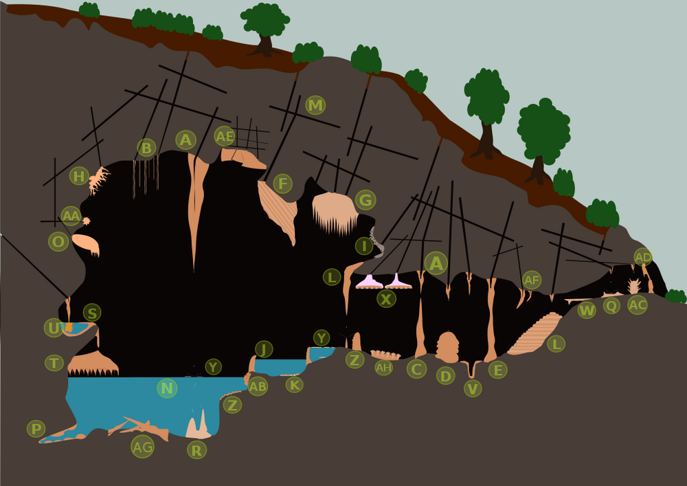
Some amusing terms for speleothems: (A) Stalactite (B) Soda straws (C) Stalagmites (D) Coned stalagmite (E) Stalagnate or column (F) Drapery (G) Drapery (H) Helictites (I) Moonmilk (J) Sinter pool, rimstone (K) Calcite crystals (L) Sinter terrace (M) Karst (N) Body of water (O) Shield (P) Cave clouds (Q) Cave pearls (R) Tower cones (S) Shelfstones (T) Baldacchino canopy (U) Bottlebrush stalactite (V) Conulite (W) Flowstone (X) Trays (Y) Calcite rafts (Z) Cave popcorn or coralloids (AA) Frostworks (AB) Flowstone (AC) Splattermite (AD) Speleoseismites (AE) Boxworks (AF) Oriented stalactite (AG) collapsed rubble. Image credits: chris via Wikimedia Commons CC BY.
A speleothem forms when minerals accumulate over time in natural caves, usually in landscapes of lime or chalk, and result in a distinct geological formation. Lime and chalk landscapes, also known as calcareous landscapes due to the presence of calcium carbonate, are exceptionally susceptible to rainwater. When rainwater flows over or trickles through cracks in calcareous formations, it reacts to form mild carbonic acid that rapidly dissolves the calcium carbonate. The shape of these speleothems depends on the environment and time over which they were deposited. The most common or better-known speleothems are stalactites (on the ceiling) and stalagmites (on the ground). Over time, both chalk and limestone develop into distinct, rain-carved landscapes — with chalk less susceptible than limestone. These landscapes are known as 'karst'. I'd written about karst landscapes previously, yet there's a more intriguing reason I'm mentioning speleothems (formations you're likely to see in karstscapes). Speleothems provide an archive of monsoon history and therefore, paleoclimate, especially in regions with strong seasonal rainfall. Speleothems are geometric accumulations not just of minerals but also of radioactive elements such as isotopes of oxygen (δ18O) and carbon (δ13C). These isotopes are used to track variations in rainfall temperature, precipitation, and vegetation changes over the past ~500,000 years via radiocarbon and uranium/thorium dating techniques. Recent research from the Kumaon and Garhwal in Uttarakhand (5700-year-old record in cave deposits written by @rapiduplift), and Mawmluh cave in Meghalaya, has traced ancient wet and dry spells from speleothem transects. Cherrapunjee or Sohra (as the locals call it), with its intense rainfall, also has spectacular subterranean labyrinths — after all, the Jaintia, Garo and Khasi hills are mostly limestone formations, with over 1580 caves documented to date, many of which are still to be explored. Yet limestone mining driven by the cement industries endangers these caves, and may forever destroy some vital clues to our past.
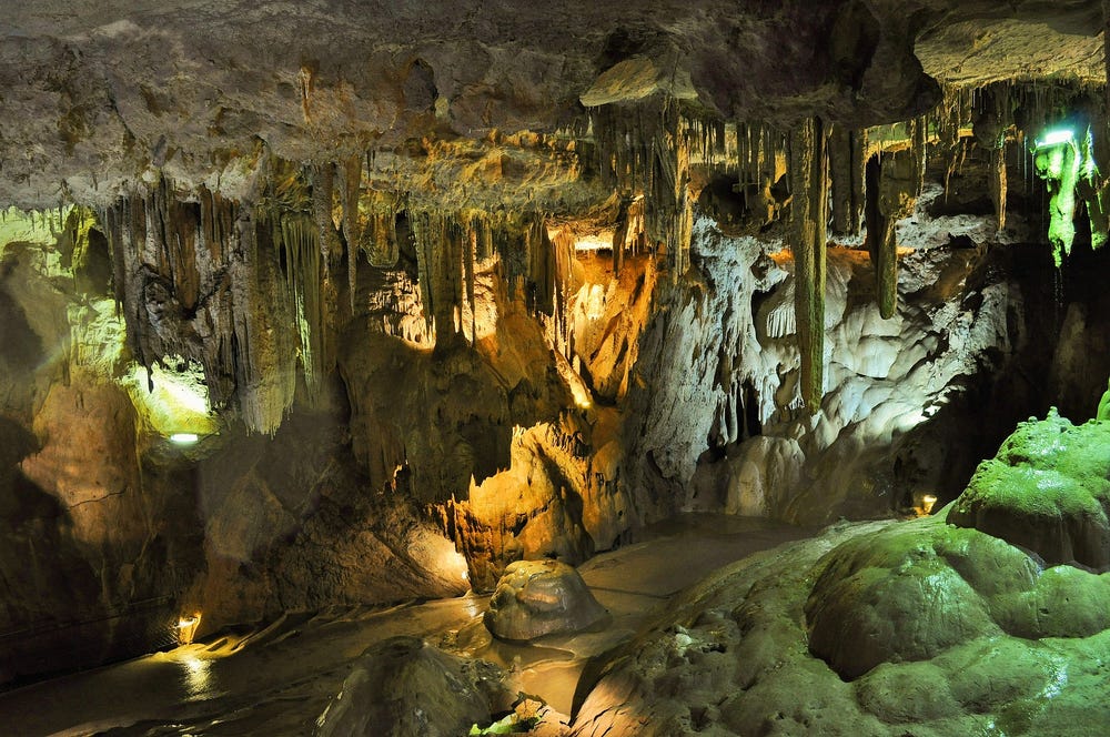
A majority of speleothems are calcareous (made of calcium carbonate minerals) in nature, though the occasional calcium sulphate and opal speleothem have also been found. Calcareous speleothems are mostly translucent or colourless, yet the presence of other minerals/impurities can lend them different colours: iron oxide (red), copper (reddish brown), manganese oxide (dark brown or black), silt (muddy). Image credits: Skitterphoto via Pixabay.
LATERITE OUTCROPS
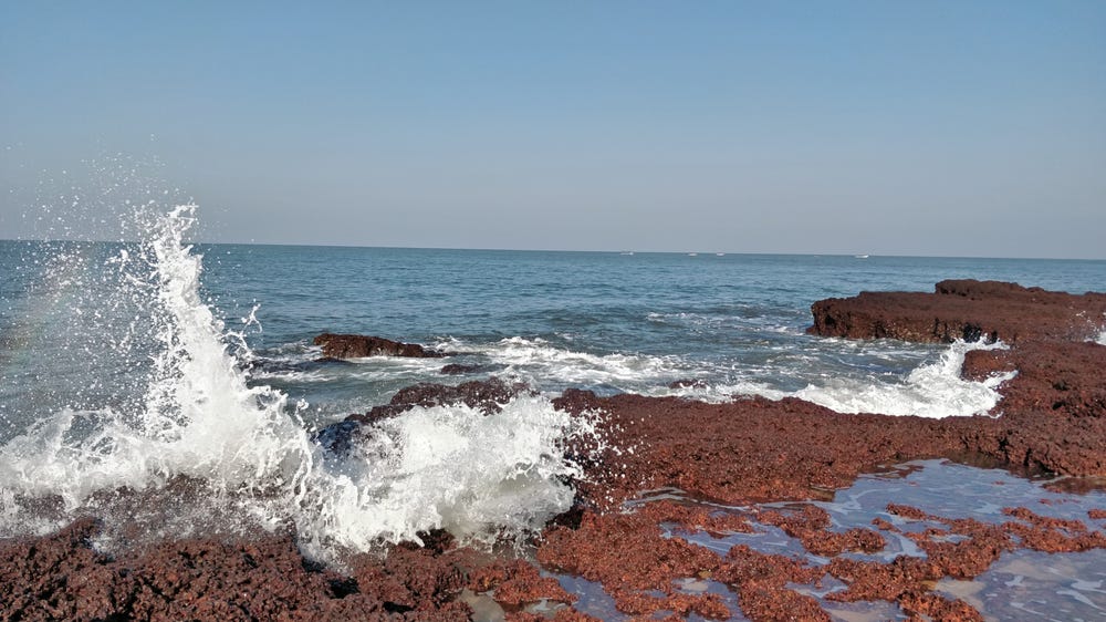
As the Western Ghats dip towards the coast, laterites formed over years of action by the rain, continue to get lashed and leached by the sea. Image credits: emvee_digital via Pixabay.
While limestone landscapes are shaped rather rapidly, basalt plateaux like the Deccan Traps undergo a slower, more inexorable change when exposed to the rains. When a volcanic landscape undergoes heavy tropical rains and high temperatures over millennia, a process called 'leaching' occurs — where nutrients like nitrogen, phosphate, and calcium, dissolve in rainwater and are carried away, leaving behind less-soluble iron, aluminium and silica. These minerals: iron, aluminium and silica, form rugged, hard-topped landscapes. If you've ever travelled through Goa, the Satara district in Maharashtra — including Panchgani and Mahableshwar, Uttara Karnataka, or Kasargod (Kerala), and remarked upon the staggering reddish-brown features, you were marvelling at laterite formations. The term laterite has been used for a broad array of features, and finding a precise description is difficult. While there are a few theories for the formation of laterites (and a further hair-splitting over primary and secondary laterites), most agree that they are a result of deep, in-situ chemical weathering, resulting in reddish-brown assemblages. Laterite may be made up of minerals like iron or aluminium oxides, oxyhydroxides or hydroxides, as well as kaolinite (a clay-like mineral) or quartz (the shimmery specks or veins in rocks). Laterite rocks are best known for their Swiss-cheese-like nature — with lots of air pockets or wormholes (vesicular or vermiform, for the word-nerds).
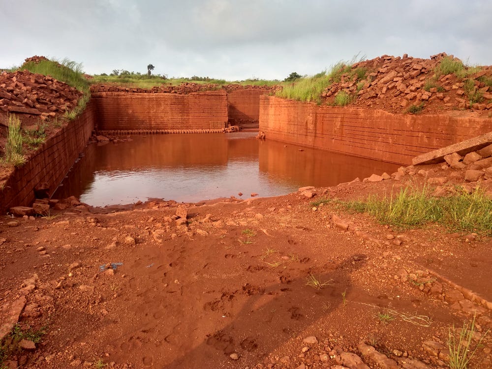
A laterite rock quarry filled with rainwater near Ratnagiri, Maharashtra, India. Image credits: Hiway.Sharma via Wikimedia Commons.
Most sources agree that the laterization process started in the late Cenozoic era (~33.9 million years ago, well after the Deccan Traps were laid down by volcanic activity). Due to rainfall patterns and temperatures being similar across the western edge of the peninsula, laterites formed as an extensive, continuous belt stretching from Mumbai to Trivandrum. Over time, rain-fed rivers born in the lofty Western Ghats deeply dissected the laterite belt. Today, we see a mosaic of table lands - discrete, hard-topped plateaux, the fragmented remains of the laterite belt, all along the western coast.
RELATED POSTS


